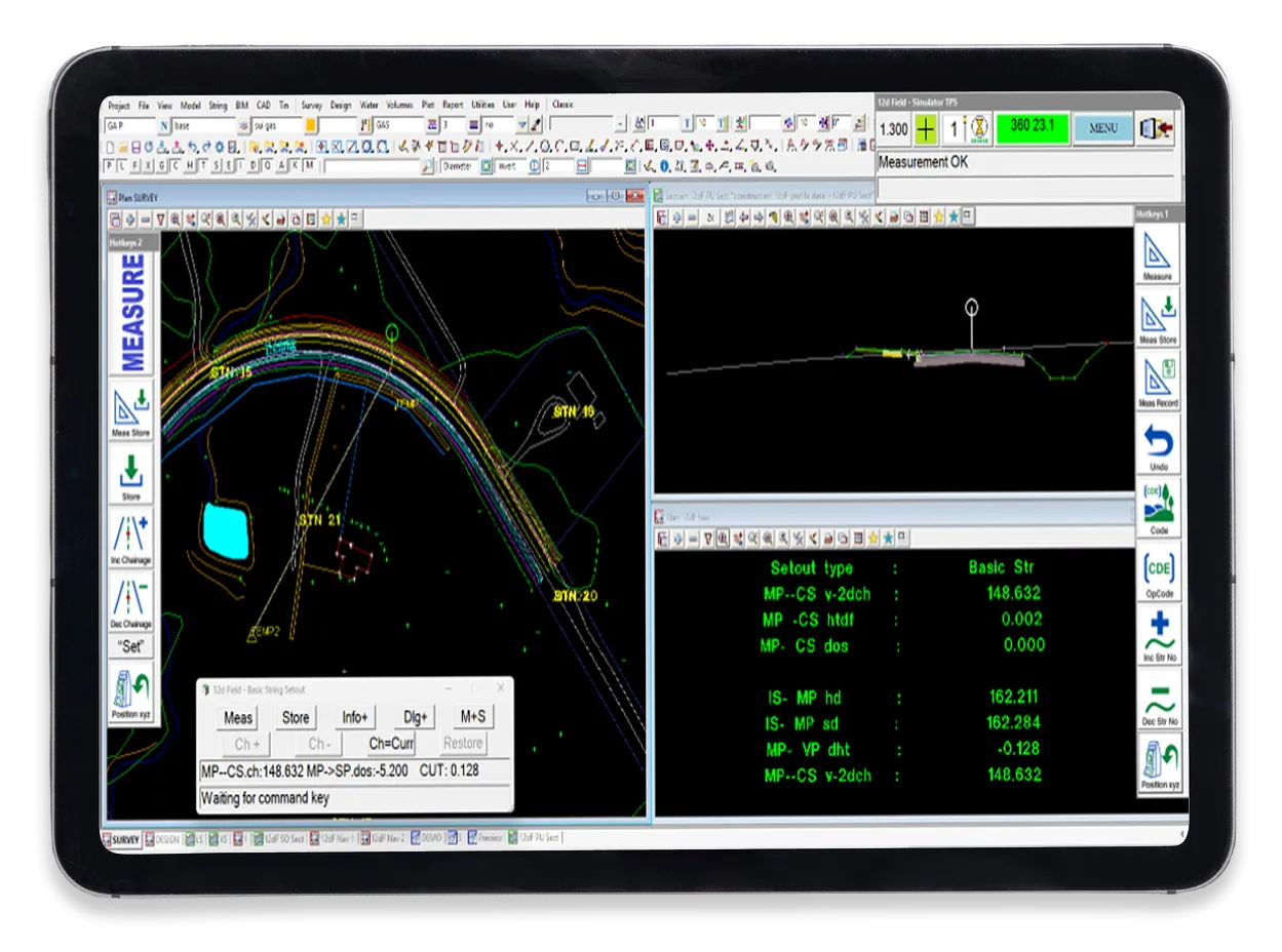
Key Features of 12d Field

Agnostic Solution
Large variety of input and output formats available from the software to cater to most requirements. Connectivity to most major surveying GNSS receivers. With Leica, Topcon and Trimble robotic total stations supported.
Pick-up
Simplify data collection with easy-to-manage coding and real-time mapping of utilities to 3D structures, reducing post-processing. Its customisation options help maintain company standards.
Setout
Streamlines complex construction tasks with tools for easy setout of points, strings, batters, surfaces , grids, tunnels, and crossfalls. View your current position in 3d, cross section and plan views simultaneously.
Mapfile Efficiency
Automatically apply standard string properties (pipelines), symbols and attributes to collected data via a customised mapfile, negating the need to return to the desktop for post processing.
Survey Data Reduction
Ability to check, edit and apply adjustments to field measurements and observations in the field or in the office. 12d Field’s native field file format provides a auditable data record.
Traverse Spreadsheets
Enter cadastral data via keyboard or screen with automatic drafting in grid coordinates. Adjustments include Bowditch, compass, transit, and least squares, with unlimited spreadsheet creation and re-editing.
Transformations
Supports zone conversions, Latitude/Longitude, UTM projections, and transformations like affine, 2D/3D Helmert, and NTv2 grids. Elevation adjustments include constant planes or difference surfaces.
Tunnels
Develop and manage user-defined tunnel profiles. Visualize and set out tunnels, generate conformance reports and plots between design and as-builts or tunnel lining thicknesses.
Conformance Reporting
In-built reporting options gives the ability to test surveyed points, lines and TINs against user-defined tolerances, and generate an associated report. Simple options to insert revised conformance data after areas of rework.
Estate Lots
Create house lots for residential developments with various methods, preserve frontages and areas, and label lots with bearings, distances, and lot types.
Machine Control
12d Model supports machine control output formats for major manufacturers, eliminating double handling of data for surveyors. Providing a one solution software for all site needs.
Point Cloud
Import point cloud data, view and reduce point density for efficient triangulation, and integrate it into the design process.
Drafting and Reporting
Automatically generate plans, profiles, and cross-sections, and customize outputs for CAD or reporting standards, streamlining drawing production.
Integrated CAD Functionality
12d Model offers integrated CAD functionality for drafting and output, with full compatibility with major CAD packages when needed.
Design Automation
Link commands to automate repetitive design tasks, improving efficiency for plotting, creating plans, and recalculating alignments and surfaces.
What’s new in 12d Field
Import from TIF,TGA,PNG, JPG, GIF, ECW, DIIB, BMP, DDF, Ml,F, HGT, LAS, Land XML, PTS, TR, MOS, CRD, GEN, l:NP, MS Excel, DXF, DWG, DGN, IDEM, ASCII, SHP, TXT, DAT, SUR, 12DA, 4DA, IFC, OBJ, FBX and more
Export to IFC, KML, PTS, TAB, Land XML, MOS, MS Excel, DXF, DWG, DGN, GRD, OEM, ASCIII, SHP, TXT, 12DA, 4DA, TN3, LN3, RD3, PT3, TTM.
Interface directly with all major survey equipment manufacturers.
Set out File creation for upload to GNSS, Total stations or controllers.
Survey data reduction with advanced Editing tools and QA checking and reporting.
12d Field Setout options: Single String, Batter, Surfaces, Crossfall, Point, Grid, Tunnel.
Subdivision/Parcel/Estate design and set out functionality.
Geodetics, Conversions and adjustments-All survey systems supported.
Stockpile Calculation & Reporting – volumes and surface area calculations.
Conformance-Tunnels, batters, pavements, etc.
Cogo functionality.
Point cloud processing & viewing.
CAD-wide range of drafting functions.
Reports-Custom reports for volumes, conformance, quality, etc.
Multi-Plot-automated creation of plan, profile and cross-section sheets.
Multi view-Plan, profile and perspective windows to view design from all angles.
Multi-user-Unlimited number of users working with the same data.
Design Automation-tools to automate repetitive tasks and instantly recalculate design elements.
Custom commands-flexible programming language to create custom commands for your business.